")
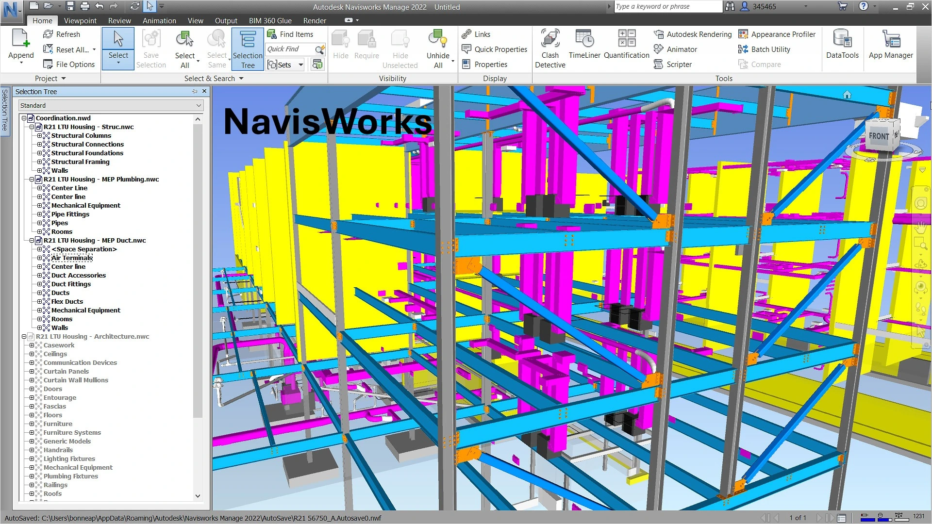
Navisworks is a 3D design review software developed by Autodesk that plays a crucial role in the CAD interoperability ecosystem. As a coordination and project review tool, it allows combining 3D models from various sources and formats to create a complete and coherent project model. Let's discover in detail how Navisworks facilitates CAD data exchange and optimizes collaborative workflows in construction projects.
History and uses of Navisworks software
Acquired by Autodesk, Navisworks has established itself as one of the most reliable review and coordination tools used by construction project managers and VDC (Virtual Design and Construction) professionals. Its development was guided by the need to create a common platform where different models designed on various platforms can be analyzed and coordinated.
Main uses and benefits
Navisworks is primarily used for:
- Detecting and resolving conflicts between different disciplines (structure, MEP, architecture)
- Coordinating complex projects
- Construction simulation and planning (4D)
- Project visualization for client presentations
- Estimation and quantification for quotes (5D)
The software offers considerable advantages in terms of collaboration, including:
- Early detection of conflicts before construction
- Complete project visualization
- Temporal simulation of the construction process
- Accurate project estimation
- Improved risk management
- Streamlined communication between stakeholders
The Navisworks geometric engine
The Navisworks geometric engine is specially designed to optimize rendering and spatial analysis of complex models. It uses simple tessellated geometry that enhances performance when handling large models.
Structure of the geometric engine
Navisworks employs a spatial graph for all spatially oriented operations such as rendering, selection, collision detection, and clash detection. The leaves are self-contained instances comprising a bounding box, transformation, material, and geometry definition, all stored in a format optimized for rendering.
To efficiently support spatial queries, Navisworks uses a hierarchy of spatial bounding boxes (a variant of R-tree). This structure allows the software to quickly process large and complex models.
Data organization
The Navisworks data model is written in separate streams, in the order they are typically read:
- The logical scene graph
- The spatial hierarchy
- The set of instances
- Separate streams for each functionality with its own metadata (clash tests, saved viewpoints, selection sets, etc.)
This organization not only allows loading data on demand but also adding new functionalities without having to modify the file format, thus ensuring compatibility with previous versions.
Navisworks native file formats
Navisworks uses three native file formats, each with specific characteristics and uses:
NWD Format
An NWD file contains all model geometry along with Navisworks-specific data, such as review annotations. This format can be considered as a snapshot of the current state of the model. NWD files are very lightweight, compressing CAD data up to 80% of their original size.
NWF Format
An NWF file contains links to the original native files (listed in the selection tree) along with Navisworks-specific data. No model geometry is saved with this format, which makes an NWF file considerably smaller than an NWD.
NWC Format (cache files)
By default, when you open or append native CAD files or laser scans in Navisworks, a cache file is created in the same directory and with the same name as the original file, but with the .nwc extension. These files are smaller than the original files and speed up access to frequently used files.
Supported CAD and laser scan formats
Navisworks supports a wide range of CAD and laser scan file formats, making it an extremely versatile tool for data interoperability.
CAD formats supported in NavisWorks 2025
Navisworks can open many native CAD formats without requiring the corresponding CAD applications to be installed on your machine:
- CATIA V4: .model, .session, .exp, .dlv3
- CATIA V5: .CATPart, .CATProduct, .cgr
- CIS/2: .stp
- DWF: .dwf, .dwfx, .w2d
- DWG/DXF: .dwg, .dxf
- FBX: .fbx
- IFC: .ifc
- IGES: .igs, .iges, .ige
- Inventor: .ipt, .iam, .ipj
- JT: .jt
- MicroStation Design: .dgn, .prp, .prw
- NX: .prt
- OBJ: .obj
- Parasolid: .x_b, .x_t, .xmt_txt
- PDF: .pdf
- PDS: .dri
- Pro/ENGINEER: .prt, .asm, .g, .neu
- Revit: .rvt, .rfa, .rte
- Rhino: .3dm
- RVM: .rvm
- SAT: .sat, .sab, .smt, .smb
- SketchUp: .skp
- SmartPlant 3D: .vue
- SolidWorks: .prt, .sldprt, .asm, .sldasm
- STEP: .stp, .step, .stpz, .ste
- STL: .stl, .stla, .stlb
- 3D Studio: .3ds, .prj
Laser scan formats supported in Navisworks 2025
Navisworks can also open various laser scan file formats:
- ASCII Laser File: .asc, .txt
- Leica: .pts, .ptx
- ReCap: .rcs, .rcp
Navisworks versions and types
Autodesk offers three distinct versions of Navisworks, each tailored to specific needs in the design and construction industry:
- Navisworks Freedom (beginner level): This is the simplest and free version of the software, often called the Navisworks "viewer." It allows viewing Navisworks files in .NWD and .DWF formats. Although it lacks the advanced features of paid versions, it offers valuable functionality that allows stakeholders to navigate and examine the model without modifying it.
- Navisworks Simulate (intermediate level): This intermediate version offers more advanced features than Freedom, particularly allowing 4D simulations by integrating construction schedules with 3D models.
- Navisworks Manage (advanced level): This is the most comprehensive version, designed to offer complete project review solutions to design and construction professionals. It provides advanced tools for 5D analysis, interference analysis, and spatial coordination.
Plugins and extensions for Navisworks
Navisworks' open architecture allows the use of numerous plugins developed by Autodesk and third parties to extend its functionality. These plugins can be installed automatically or manually depending on their type.
Popular paid plugins
- Navistools Quantification: An advanced plugin that provides powerful tools for surveying and extracting quantities from Navisworks models, crucial for accurate estimation of materials and costs.
- Advanced Work Packaging (AWP): This plugin helps streamline project delivery by breaking down complex tasks into smaller, manageable work packages, particularly useful in large construction projects.
Essential free plugins
- Asite 3D Repo: Enhances collaboration by allowing users to directly connect their Navisworks models to the 3D Repo cloud platform, enabling teams to review and manage 3D models in real-time.
- Coordination Add-in for Navisworks: Essential for teams working on complex projects, it allows easy detection and resolution of conflicts, ensuring that different project elements work together harmoniously.
- Navisworks Plugin for Revit: Ensures smooth transfer of models between Revit and Navisworks, allowing users to import Revit models into Navisworks for detailed review and analysis.
- Navisworks VR Plugin: Allows users to experience 3D models in a fully immersive environment, helping clients and stakeholders better understand the project.
- Enscape for Navisworks: Brings high-quality real-time rendering to your BIM workflow, allowing instantaneous visualization of changes, ideal for project presentations or meetings with clients.
Integration with Autodesk Construction Cloud
Navisworks integrates seamlessly with Autodesk Construction Cloud, offering additional capabilities for BIM management and collaboration. This integration allows for better management of construction data throughout the project lifecycle, ensuring smooth communication between all stakeholders.
CAD Interop solutions for Navisworks
CAD Interop distributes several software solutions to visualize and convert Navisworks files, thus enhancing interoperability and collaboration in your projects.
3DViewStation for visualizing and analyzing Navisworks models
3DViewStation is a powerful solution for visualization, analysis, and conversion of CAD data, including Navisworks models. Its advanced features allow users to:
- Quickly visualize complex 3D models
- Perform precise measurements
- Analyze geometries to detect potential problems
- Create sections and exploded views
- Export to various formats for seamless collaboration
Thanks to its intuitive interface and optimized performance, 3DViewStation is an ideal complement to Navisworks for teams that need to efficiently analyze and share CAD models.
SimLab for creating immersive experiences from Navisworks models
SimLab allows transforming your Navisworks models into immersive virtual reality experiences, offering new perspectives for project presentation and analysis. With SimLab, you can:
- Directly convert Navisworks models into VR environments
- Organize interactive virtual tours
- Simulate real usage scenarios
- Facilitate decision-making through immersive visualization
- Improve communication with clients and stakeholders
This solution adds an extra dimension to your Navisworks projects, allowing a more intuitive and in-depth understanding of designs.
Best practices for exchanging Navisworks models
To maximize the efficiency and reliability of data exchanges with Navisworks, here are some recommendations:
Preparing models for exchange
- Use NWC files to speed up loading times during repeated uses
- Organize your model into logical subsets to facilitate navigation
- Clean up non-essential data before exporting to reduce file sizes
- Check the quality and integrity of models before combining them in Navisworks
Performance optimization
- Use appropriate Level of Detail (LOD) techniques according to project needs
- Leverage Navisworks' caching capabilities for frequently used files
- Divide large models into manageable subsets to improve performance
- Use NWD files for sharing with external partners (contains all necessary data)
Collaboration and coordination
- Establish clear protocols for file naming
- Define common reference points for all models to be combined
- Use DEXcenter to automate and secure CAD data exchanges with partners
- Document the standards and conventions used in the project
Data security
- Take advantage of the secure web environment of solutions like DEXcenter for secure transmission of sensitive proprietary CAD data
- Use data encryption during transfer over the Internet to prevent interception
- Maintain a record of each exchange to validate what was sent to each partner and when
Conclusion
Navisworks represents an essential tool in the CAD interoperability ecosystem, facilitating coordination, review, and analysis of complex construction projects. Its ability to integrate models from various sources, detect potential conflicts, and simulate the construction process makes it a valuable ally for AEC professionals.
The complementary solutions offered by CAD Interop, such as 3DViewStation and SimLab, enhance the Navisworks experience by offering additional capabilities for visualization, analysis, and immersion. For organizations seeking to optimize their CAD data exchange workflows, solutions like DEXcenter provide a secure environment for the transmission and management of Navisworks files.
By following best practices for model exchange and fully exploiting Navisworks' interoperability capabilities, project teams can significantly reduce errors, improve communication, and deliver higher quality projects in shorter timeframes.

